Friday 4th May 2007
I woke up uncomfortably warm in my sleeping bag and when I
checked the thermometer I could see why. It was 20 degrees and only
just after 6am. But I need to count my blessings as I think the warm
nights will not last much longer. I am prepared for very cold nights
when I am further into the centre of Australia and further into the
centre of winter.
The radio
sched with Roger was
very clear this morning and I was able to have a reasonable
conversation with Bill. I packed up the antenna and the rest of my gear
and was away by 7.30.
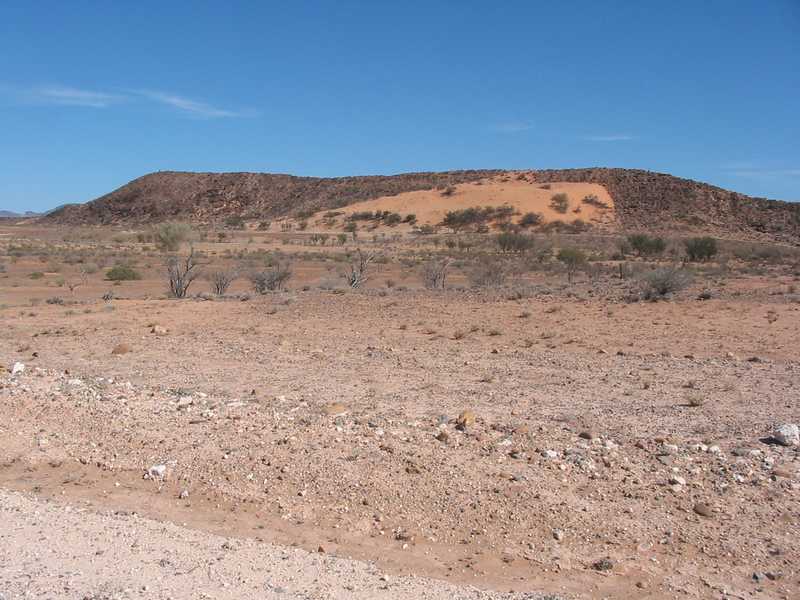
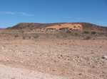
There
were now creek
crossings every 30 minutes or so and the trees were bigger and denser.
Wearing Hills, a low range to my right, was slowly coming closer to the
road. On my left, Stirrup Iron Range, slightly more imposing, was also
closing in. And, on the horizon dead ahead, I could see more hills
rising as I got closer and closer. Finally, around 10.30 I
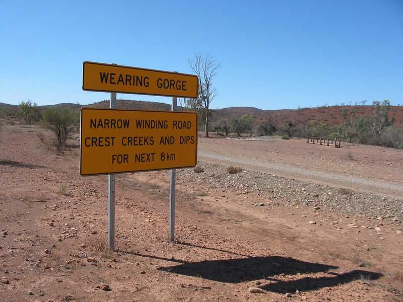
came to
the expected hard turn to the right. Unexpectedly though, there was a
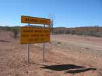
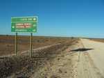
major sign telling me that I was about to walk through Wearing Gorge.
There are not very many signs in this part of the woods. There was a
road straight ahead but there was no mistaking which was the road "most
traveled". And an even "lesser" road 50 metres away heading off to my
left.
I figured this was as
good a time as any to
take a break. I had checked my maps yesterday afternoon and
knew
that the road, which has been heading NNE to due North, the direction I
want to generally follow, now went due East. I followed along the
almost indiscernible banks of Outouie Creek and its several
tributaries that took me through the Wearing Hills to where the road
again turned NNE after 11km of a very picturesque walk. And I had the
company of three emus that wandered off each time I got close. But they
always headed in the direction I was going so we were together for
nearly an hour.
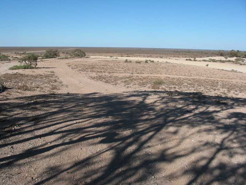
As I emerged
from the gorge, the
road started to flatten out, and after a slight rise, I was at a
junction of several fences and there was a barely usable cattle yard
with the timber posts leaning at all angles. Most imposing, was the
view of the way ahead. It was barren, flat and the road just got
narrower and narrower until it disappeared just short of where the land
met the sky in a dead straight line. I settled into my steady afternoon
walking pace with a couple of hours to go where I hoped I would find
some
substantial trees for tonight's camp. I find it amazing that I can be
walking in a pleasant, tree filled valley at noon and by 3 o'clock I
can be on a
flat, almost barren plain.
I
was contemplating the sparsity
of it all, when the way off sound of a large truck coming up
from
behind got me thinking how little traffic I was now seeing daily. It
was
so quiet "out here", not even the usually ever present bird life, that
I
could hear a vehicle long before it came alongside. Today, there would
have
been less than 10 vehicles all day, a mixture of 4WD station utes, 4WD
tourists, some with caravans, and several trucks. Three of them had
stopped and we went through the usual questions starting with
"Have you got enough water?", but the semi-trailer that was
now
pulling up beside me was a different story altogether. With a squealing
of brakes and a hiss from the compressed air system the driver stuck
his head out of the window.
"Is
this the way to Beverley Mine?"
Now, I'm not into seeking celebrity status but since I have
been
walking the outback, I have grown accustomed to being the centre of, at
least, the opening conversation. But this, typical aussie, truckie just
wanted
to confirm that he wouldn't have to drive, on what to him was a rotten
road, for another hour, just to find out he had to turn around and go
all the way back. As I have said, there aint many road signs, and often
there are turnoffs where I have had to stop and consult my maps.
"Uh. Not sure mate." I said, walking up to stand by his door.
"I haven't passed it yet. I've got good
maps. Would you like me to have a look?"
"Yeah, ta."
He
sat there, ten feet above ground level, with the air conditioner and the motor running while I
took off my pack (I didn't mind taking a break) and dug out my maps. I
have heard of Beverley Mine. It is one of only two uranium mines in
operation in Australia. But I would have put it in the Northern
Territory, not around here. So much for my geography lessons.
I climbed up onto the side of the truck and we poured over
the
map I was on and also the next few which would cover a further 60km or
so. We could not find the mine on my maps but he did recognise a tee
junction 20km
ahead where a road joined from the East that he had considered taking
up from Yunta on the Adelaide to Broken Hill road. Confident that he
had not taken a wrong turn yet, he wished me well and rattled off with
a cloud of dust and disappeared from view 10 minutes later.
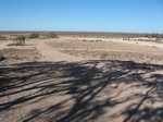
At last a serious line of trees a few kilometers ahead
promised a
creek crossing and a camping spot for tonight. When I got to it, there
was a significant, rocky bottomed, dry creek with a signpost telling me
I was at TEATREE CREEK. I found a patch of sand and set up camp, got a
fire going with plenty of
wood around and settled into my noodles and soup.
After a good radio sched and a sit around the fire with a
coffee, I retired
feeling happy with my 26 kilometers today.
Saturday 5th May 2007
20 degrees again this morning. Very pleasant and a pretty
sunrise
with no wind. I packed up and was getting my gear on when I noticed
that one of the bullet connectors on my solar panel wires was not
there. I saw that it was hanging by a thread when I disconnected
yesterday afternoon, and I had hoped that it would hold together till I
got to the ranger station at Balcanoona in a couple of days time. Tom,
the ranger at Wilpena, had told me to look up Arthur when I got to
Balcanoona so I have a sort of introduction to ease my
request to
borrow a soldering iron if one was available.
I dug
out a clip lead (a wire with a small alligator clip on each end) and
jerry rigged the solar panel connection to the battery pack to keep it
charged up.
As I did a walk
around my empty camp
site after I had fully kitted up, I spotted the errant bullet connector
on the ground. It is a small thing, no bigger than a small fuse, so I
considered myself lucky to find it. I popped it into my belly bag. It
will make the repair a lot easier.
By 9 o'clock I
had to stop and take a break to dig out my fly net. I had been waving
and swatting and clapping (surprisingly successful) at the flies but
they were winning. The face net was in a side pocket and impossible to
get while the pack was on my back. The difference (totally
psychological) is amazing and instant. It didn't seem to bother me that
they were thick on my bare forearms, in fact it was a bit of a game to
see how many I could swat with a single slap.
I
stopped again at 11.30 under the shade of a beautiful red river gum in
the bed of Moro Creek to send off my noon sat phone email and was
delighted to see that I have covered 14km already. Just off the road to
my left is a somber reminder of how tough it was out here in the
pioneering times. The grave of Peter Fagan who died of thirst on the
1st of January 1874 stands in this lonely spot partly protected by four
old wooden posts and a light railing.


When I hoisted the backpack on I decided to experiment with
the
straps to see if I could lighten the pressure on my shoulders. I had
been contemplating this for quite a while and had been given a few
minutes instructions from an "expert" at the Go Camping store where I
bought it. I say expert, because Toby had been looking after me during
my initial research and the actual sale and he called up one of the
other guys who would adjust the pack to suit me. I even had to come
back after I had bought it, filled with approximately the weight I would be
carrying. The fitting including sliding out two aluminium strips and
bending them to fit the curvature of my spine. Very professional
indeed. He showed me how to "pull these two straps" when you are
walking up hill and "these two" when walking down hill. I didn't take
too much notice of that part as I was walking in mostly flat country.
But today, I pulled the hip support belt as tight as I could stand
it and took up an inch on the shoulder strap to carry the
load
higher.
After feeling my
stomach section being
squeezed to death for half an hour I eased it off a bit. But it
certainly took the weight off the shoulders. The low hills to my left
were now showing small sections of sand. And the latest one was nearly
half sand. And I could see a trig point, a pile of rocks high on the
southern end of this hill.
It
was getting late-ish in the afternoon when I spotted the buildings of
Wertalooma station. This was a good time of day to drop in and
introduce myself and meet the folks. Warren, from Wirrealpa, had told
me I should call in as I would get a warm welcome. But there was no one
home. There was a nice green lawn (inviting for a camping spot) in the
centre area with a bare flag pole in the middle. But as much as I
called out I could not raise anybody. I took one of my water bottles
and wandered over to the "men's quarters" to look for a tank. I like
to keep away from the homestead respecting their privacy.
I found a tank out back with a tap and couldn't help noticing
an
ablution block with a toilet door open. Never one to let a chance go
by, I "borrowed" it.
I suited
up again but found a
severe problem with my battery pack. My "jerry rig" with the clip lead
was too rough. I must have had a short circuit with two metal bits
touching and shorting out the batteries. This had made them very hot
and the plastic battery holder, that took all ten AAs nicely, now had
the negative end springs melted into the plastic case. Yuk. What a
mess. And not repairable at all. And I hate to admit it, but this is
the second 10 AA case that I have melted in exactly the same way.
Careless, careless, careless. Not a big problem in the city but this
would test my ingenuity.
But,
"get used to it
Jeff". I put it together as best I could, wrapped it with electrical
tape (yep, I did carry some and used it often), and headed back to the
main road. Back on the road, a truck stopped heading south and we
talked about my walk and also about his round trip from Adelaide to
Beverley Mine carting wallboard for the extensive building program
going on there. I finally found out that the Beverley Mine is a further
100km up the road, way past the maps I was looking at earlier.
Just a couple of kilometers up the road I came on a nice
creek,
dry of course, and set up camp. I was delighted to find, on consulting
my map, that it was called "Big John Creek". He's still looking after
me. Actually, Big John Creek was designated off to my right a bit, this
part of the waterway was possibly Mount McKinlay Creek. But it is still
nice to be reminded of the good friendship that we built in my week in
Hawker.
Tomorrow, on to
Balcanoona Ranger Station and meet some more interesting people